History
Ancient history and settlement.
Cairo has its roots in the ancient settlement of Memphis, now 24km (15 miles) southwest of the city. It was founded in 2,000 BC and ruled by King Menes who united Upper and Lower Egypt. In the 1st century, the Romans built the Babylon fortress on the Nile, the oldest structure in the city.
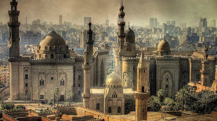
Cairo itself was established as the city of Fustat by the Fatimids in the 10th century. So began a period of huge construction of prominent landmarks, including Al-Azhar mosque. As Cairo was a key link on the east-west spice route, the market streets of Khan el-Khalili became a bustling centre of trade.

Geography
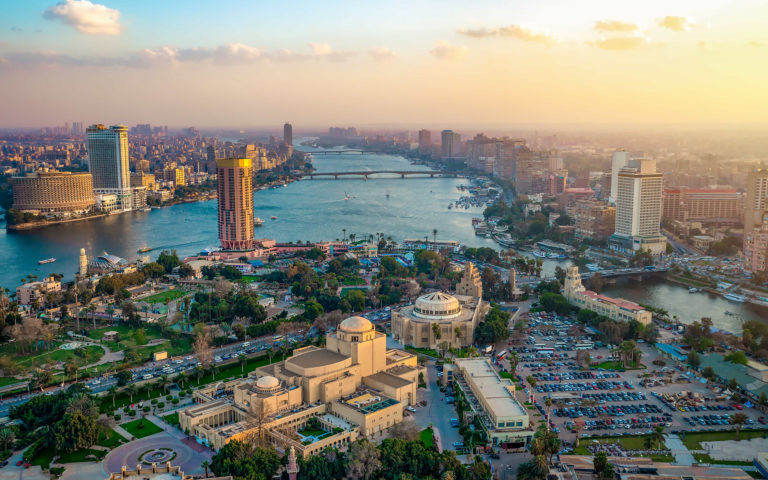
Cairo is located in northern Egypt, known as Lower Egypt, 165 kilometres (100 mi) south of the Mediterranean Sea and 120 kilometres (75 mi) west of the Gulf of Suez and Suez Canal. The city lies along the Nile River, immediately south of the point where the river leaves its desert-bound valley and branches into the low-lying Nile Delta region. Although the Cairo metropolis extends away from the Nile in all directions, the city of Cairo resides only on the east bank of the river and two islands within it on a total area of 453 square kilometres (175 sq mi). Geologically, Cairo lies on alluvium and sand dunes that date from the quaternary period.
Until the mid-19th century, when the river was tamed by dams, levees, and other controls, the Nile in the vicinity of Cairo was highly susceptible to changes in course and surface level.
Cairo Tours

Geschichte
Alte Geschichte und Siedlung.
Kairo hat seine Wurzeln in der antiken Siedlung Memphis, die heute 24 km südwestlich der Stadt liegt. Es wurde 2.000 v. Chr. gegründet und von König Menes regiert, der Ober- und Unterägypten vereinte. Im 1. Jahrhundert bauten die Römer die Festung Babylon am Nil, das älteste Bauwerk der Stadt.
Kairo selbst wurde im 10. Jahrhundert von den Fatimiden als Stadt Fustat gegründet. So begann eine Zeit des riesigen Baus prominenter Wahrzeichen, einschließlich der Al-Azhar-Moschee. Da Kairo eine wichtige Verbindung auf der Ost-West-Gewürzstraße war, wurden die Marktstraßen von Khan el-Khalili zu einem geschäftigen Handelszentrum.

Geographie
Kairo liegt im Norden Ägyptens, bekannt als Unterägypten, 165 km südlich des Mittelmeers und 120 km westlich des Golfs von Suez und des Suezkanals. Die Stadt liegt am Nil, unmittelbar südlich der Stelle, an der der Fluss sein wüstennahes Tal verlässt und in die tief liegende Region des Nildeltas abzweigt. Obwohl sich die Metropole Kairo in alle Richtungen vom Nil weg erstreckt, liegt die Stadt Kairo nur am Ostufer des Flusses und zwei Inseln darin auf einer Gesamtfläche von 453 Quadratkilometern. Geologisch liegt Kairo auf Schwemmland und Sanddünen, die aus der Quartärzeit stammen.
Bis Mitte des 19. Jahrhunderts, als der Fluss durch Dämme, Deiche und andere Kontrollen gezähmt wurde, war der Nil in der Nähe von Kairo sehr anfällig für Kurs- und Oberflächenänderungen.


